Objective : Making a movie from the sky of a landscape or city. A video montage can be done with song and pictures inserts. Documents provided : USB stick or DVD
drone
3d topographic map
Objective : make a surveyor working very quickly with the aim of calculating volumes of earth to move, create profiles, analyze the slopes of the existing (and proposed), modeling storm basins, simulate flood … Documents provided : DWG, DXF or DEM and paper plan. The shooting is rasterized and can be used in GIS (Geographic… Read more »
Mapping
Documents provided : DWG or DXF file, map on paper. The shooting is rasterized and can also be used in GIS (Geographic Information System).
Orthophotograph creation
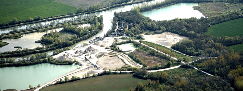
Objective: Take aerial pictures geometrically corrected (“orthorectified”), perpendicular to the ground and geo-referenced for use as maps. They can be inserted into a GIS used for PLU, an impact study … Documents provided: raw image folder or file from a blended picture
Aerial Pictures
Objective : Take aerial pictures (monuments, building, natural spaces, construction fields …) Documents provided: jpg image (or other format) on USB key
New generation statement devise.
 Our drone is an Unmanned Aerial Vehicle able to work a 5km radius around the operator.
His control is manual or automatic via satellite. Its aerodynamic profile allows it to fly even without the electric motor.
Our drone is an Unmanned Aerial Vehicle able to work a 5km radius around the operator.
His control is manual or automatic via satellite. Its aerodynamic profile allows it to fly even without the electric motor.